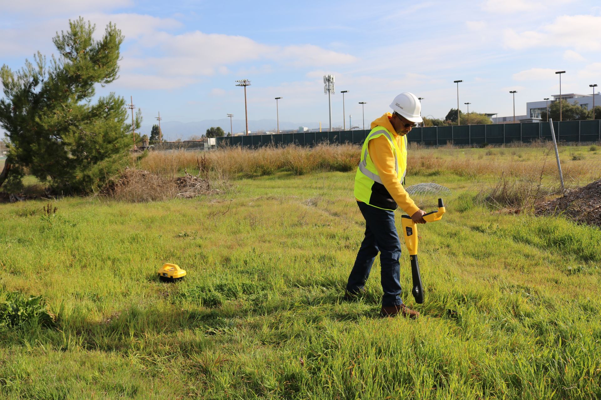
vLoc3-5000
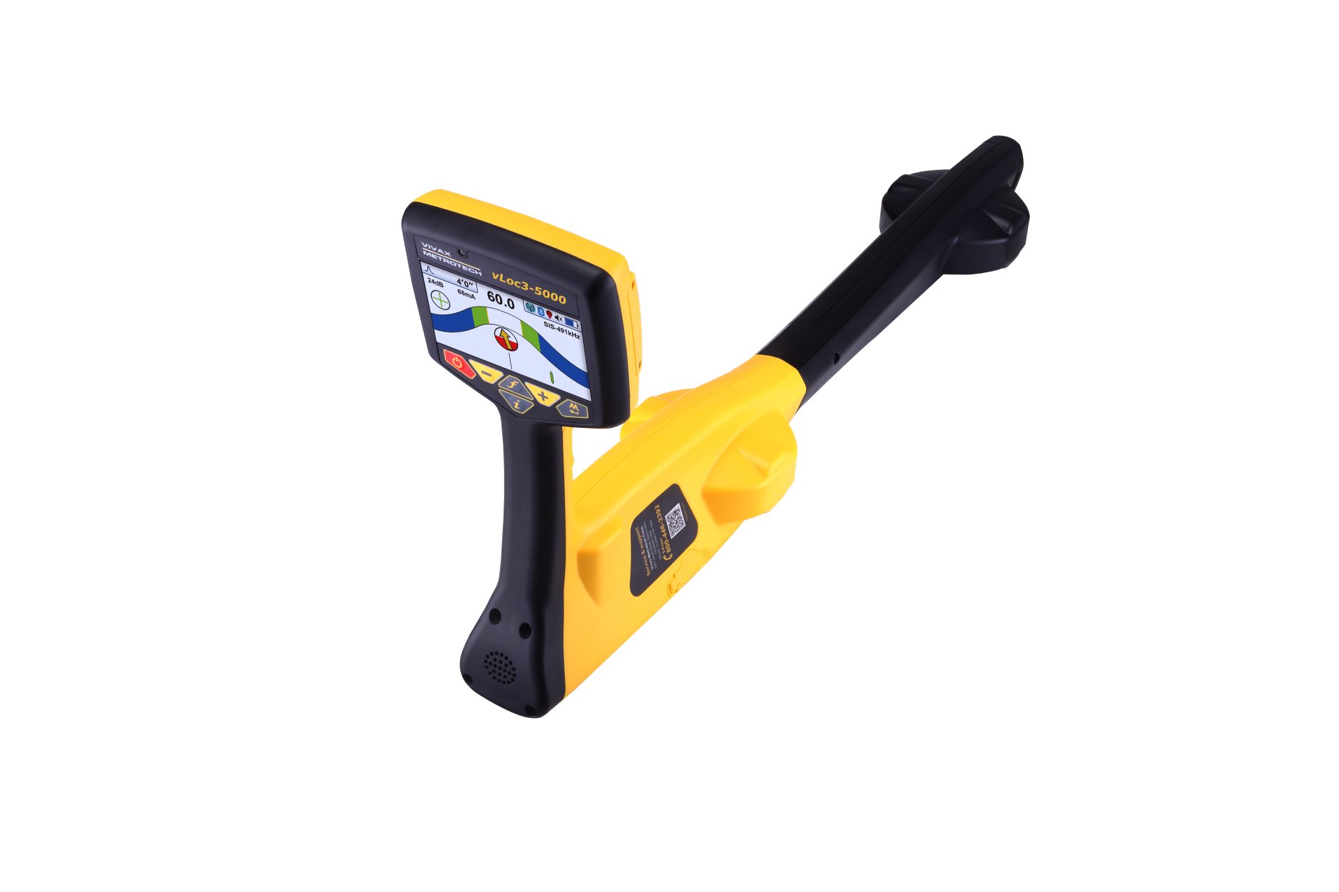
The vLoc3-5000 utility locator brings an innovative element of digital signal processing, position capturing and broadband frequency selection to buried utility locating. Data captured by the internal GPS or external GPS via Bluetooth can be downloaded for further analysis, use with GIS systems or google maps. Use the free VM-MAP smartphone application to create real-time maps with GPS data and data from the locator such as time, date, depth of cover, current on the line, and add custom comments to each entry.
With two sets of screened 3D antennas signal distortion is easily detected and displayed on the bright full color display. Along with classic locate screens the vLoc3-5000 locator offers new locate perspective screens of Vector Locate for fully automatic non-walk over locating, Transverse Graph showing both peak and null simultaneously providing immediate measurement of signal distortion, Plan View showing the relative orientation of the cable at any angle, and a new graphical Sonde screen with guidance arrows leading to the sonde location even when it is vertical.